Click the subject to read more
History
Originally inhabited by the Khoisan people, the region which comprises modern Zambia was colonised during the Bantu expansion of the thirteenth century. After visits by European explorers in the eighteenth century, Zambia became a British protectorate known as Northern Rhodesia towards the end of the nineteenth century. For most of the colonial period, the country was governed by an administration appointed from London with the advice of the British South Africa Company.
Geography
Located in South-Central Africa, Zambia is a country covering an area of 752,614 Kilometre squares. It is bordered by Tanzania (in the North), Malawi (in the East), Mozambique (in the South-East), Zimbabwe (in the South), Botswana and Namibia (in the South-West), Angola (in the West) and the Democratic Republic of Congo (in the North-West).
The country’s geographical location and high altitude are ideal for the country’s sub-tropical vegetation and climate conditions. There are three distinguished seasons: a warm wet season (Nov-April), a cool dry season, (May-August), and a hot dry season (September-October).
Temperatures range from 15-33 degrees Celsius or 59-91 degrees Farenheight. The average annual rainfall in a normal season is 1000mm with the northern parts of the country experiencing the highest rainfall averaging more than 1400 mm annually.
Zambia is divided into ten provinces, each administered by an appointed deputy minister. Each province is subdivided into several districts.
Zambia is drained by two major river basins: the Zambezi/Kafue basin in the centre, west and south covering about three-quarters of the country; and the Congo basin in the north covering about one-quarter of the country. A very small area in the northeast forms part of the internal drainage basin of Lake Rukwa in Tanzania.
Two of the Zambezi’s longest and largest tributaries, the Kafue and the Luangwa, flow mainly in Zambia. Their confluences with the Zambezi are on the border with Zimbabwe at Chirundu and Luangwa town respectively. Before its confluence, the Luangwa River forms part of Zambia’s border with Mozambique. From Luangwa town, the Zambezi leaves Zambia and flows into Mozambique, and eventually into the Mozambique Channel.
The Zambezi falls about 100 metres (328 ft) over the 1.6 km (0.99 mi) wide Victoria Falls, located in the south-west corner of the country, subsequently flowing into Lake Kariba.
The north of Zambia is very flat with broad plains. In the west the most notable being the Barotse Flood plains on the Zambezi, which floods from December to June, lagging behind the annual rainy season (typically November to April). The flood dominates the natural environment and the lives, society and culture of the inhabitants and those of other smaller, floodplains throughout the country.
In Eastern Zambia the plateau which extends between the Zambezi and Lake Tanganyika valleys is tilted upwards to the north and so rises imperceptibly from about 900 m (2,953 ft) in the south to 1,200 m (3,937 ft) in the centre, reaching 1,800 m (5,906 ft) in the north near Mbala. These plateau areas of northern Zambia have been categorised by the World Wildlife Fund as a large section of the Central Zambezian Miombo woodlands Eco region.
Eastern Zambia shows great diversity. The Luangwa Valley splits the plateau in a curve north east to south west, extended west into the heart of the plateau by the deep valley of the Lunsemfwa River. Hills and mountains are found by the side of some sections of the valley, notably in its north-east the Nyika Plateau (2,200 m or 7,218 ft) on the Malawi border, which extend into Zambia as the Mafinga Hills, containing the country’s highest point, Kongera (2,187 m or 7,175 ft). The Muchinga Mountains, the watershed between the Zambezi and Congo drainage basins, run parallel to the deep valley of the Luangwa River and form a sharp backdrop to its northern edge, although they are almost everywhere below 1,700 m (5,577 ft). Their culminating peak Mumpu is at the western end and at 1,892 m (6,207 ft) is the highest point in Zambia away from the eastern border region.
The southernmost headstream of the Congo River rises in Zambia and flows west through its northern area firstly as the Chambeshi and then, after the Bangweulu Swamps as the Luapula, which forms part of the border with the Democratic Republic of the Congo.
Lake Tanganyika is the other major hydrographic feature that belongs to the Congo basin. Its south-eastern end receives water from the Kalambo River, which forms part of Zambia’s border with Tanzania. This river has Africa’s second highest uninterrupted waterfall, the Kalambo Falls.
Governance system
On
24th October, 1964, the country became independent of the United
Kingdom and then-prime minister, Dr. Kenneth Kaunda became the inaugural
president. Dr. Kaunda’s socialist United National Independence Party (UNIP)
maintained power from the 1964 to 1991.
From
1972 to 1991 Zambia was a single-party state with UNIP as the sole-legal
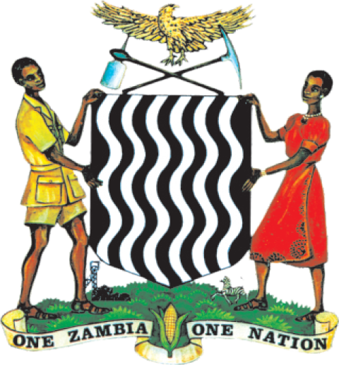
political party, with the goal of uniting the nation under the banner of ‘One
Zambia, One Nation’. Dr. Kaunda was succeeded by Dr. Frederick Chiluba of the
Movement for Multi-Party Democracy (MMD) in 1991, during which the country saw
a rise in social-economic growth and increased decentralisation of government.
Dr. Chiluba’s successor was Dr. Levy Mwanawasa, who presided over the country
from January, 2002 until his death in August, 2008.
After
Dr. Mwanawasa’s death, Mr. Rupiah Banda presided as Acting President
before being elected president later in 2008. Patriotic Front party leader, Mr.
Michael Chilufya Sata took over from Mr. Banda after the 2011 elections.
President Sata was inaugurated on 23rd September,
2011 as the fifth President of the Republic of Zambia until his death in
October 2014.
After
Mr. Sata’s death, Dr. Guy Scott presided as Acting President before Zambia’s
sixth Republican President, Mr. Edgar Chagwa Lungu was elected in a
presidential by-election in January 2015, and later in August, 2016 in
scheduled national elections.
Zambia
now has its seventh Republican President, His Excellency Mr. Hakainde
Hichilema, who ascended to power after defeating Mr. Lungu in elections held on
12th August 2021.
The
Vice-president is Her Honour Mrs. Mutale Nalumango, who was President
Hichilema’s running mate in the 12th August elections.
Zambia
is a unitary republican state with the Executive, Legislature and the Judiciary
operating as autonomous organs of Government. The Executive is headed by the
President of the country, the Legislature by the Speaker of the National
Assembly while the Judiciary is headed by the Chief Justice.
The
President (who must belong to a registered political party) and members of
Parliament (the Legislature) are elected by the people on a five-year term of
office. The President appoints his cabinet from among the elected members of
Parliament. He also has power to nominate eight members of Parliament, from
among whom he can also make appointments into the cabinet or any other position
in the Executive wing of Government. The Parliament comprises 150 elected
members and up to eight members nominated by the President.
The
country’s main political parties include the ruling the ruling United Party for
National Development (UPND), the Patriotic Front (PF) and the Movement for
Multi -party Democracy (MMD). Others include Democratic Party (DP),
Alliance for Democracy and Development (ADD), National Democratic Party (NDP), Rainbow
Party, Socialist Party, Heritage Party, National Restoration Party (NAREP), Alliance
for a Better Zambia (ABZ), United National Independence Party (UNIP), Forum for
Democracy and Development (FDD), National Democratic Focus (NDF) and Zambians
For Empowerment and Development (ZED).
The
final courts of appeal are the Supreme Court and the Constitutional Court.
Justices are appointed by the President and ratified by Parliament. The
subordinate courts are the High Court, Magistrate’s Court and Local Courts.
Culture
The culture of Zambia is mainly indigenous Bantu culture mixed with European influences. Prior to the establishment of modern Zambia, the natives lived in independent tribes, each with their own ways of life. One of the results of the colonial era was the growth of urbanisation. Different ethnic groups started living together in towns and cities, influencing each other as well as adopting a lot of the European culture. The original cultures have largely survived in the rural areas. In the urban setting there is a continuous integration and evolution of these cultures to produce what is now called “Zambian culture”.
Traditional culture is very visible through colourful annual Zambian traditional ceremonies. Some of the more prominent are: Kuomboka and Kathanga (Western Province), Mutomboko (Luapula Province), Nc’wala (Eastern Province), Lwiindi and Shimunenga (Southern Province), Lunda Lubanza (North Western), Likumbi Lyamize (North Western), Chibwela Mushi (Central Province), Ukusefya Pa Ng’wena (Northern Province).
Popular traditional arts are mainly in pottery, basketry (such as Tonga baskets), stools, fabrics, mats, wooden carvings, ivory carvings, wire craft and copper crafts. Most Zambian traditional music is based on drums (and other beating instruments) with a lot of singing and dancing. In the urban areas foreign genres of music are popular, in particular Congolese rhumba, African-American music and Jamaican reggae. Several psychedelic rock artists emerged in the 1970s to create a genre known as Zam-rock, including The WITCH, Musi-O-Tunya, Rikki Ililonga, Amanaz, the Peace, Chrissy Zebby Tembo, Blackfoot, and the Ngozi Family.
The Zambian staple diet is based on maize. It is normally eaten as a thick porridge, called nshima (Nyanja Word), prepared from maize flour, commonly known as mealie meal. This may be eaten with a variety of vegetables, beans, meat, fish or sour milk depending on geographical ethnic origin.
Sport
Zambia declared its independence on the day of the closing ceremony of the 1964 Summer Olympics, thereby becoming the first country ever to have entered the Olympic Games as one country, and left as another. Zambia took part in the 2008 Summer Olympics in Beijing.
Football is the most popular sport in Zambia, and the Zambia national football team has had its triumphant moments in football history. At the Seoul Olympics of 1988, the national team defeated the Italian national team by a score of 4–0. Kalusha Bwalya, Zambia’s most celebrated football player and one of Africa’s greatest football players in history, had a hat trick in that match.
However, to this day, many pundits say the greatest team Zambia has ever assembled was the one that perished on 28th April, 1993 in a plane crash in Libreville, Gabon. Despite this, in 1996, Zambia was ranked 15th on the official FIFA World Football Team rankings, the highest attained by any southern African team. In 2012 Zambia won the African Cup of Nations for the first time after losing in the final twice. They beat Côte d’Ivoire 8–7 in a penalty shoot-out in the final, which was played in Libreville, just a few miles away from the plane crash 19 years previously.
Rugby, boxing and cricket are also popular sports in Zambia. Notably, at one point in the early 2000s, the Australia and South African national rugby teams were captained by players born in the same Lusaka hospital, George Gregan and Corné Krige. Zambia boasts of having the highest rugby poles in the world, located at Luanshya Sports Complex in Luanshya town. Rugby in Zambia is a minor but growing sport. Zambia used to play cricket as part of Rhodesia.
Zambia also produced the first African-American (Madalitso Muthiya) to play in the United States Golf Open, one of the four major golf tournaments.
Demography
The country has an estimated population of 15 million of which 45 percent reside in urban areas, making Zambia one of the most highly urbanised countries in Africa. The main urban cities are Lusaka in the midlands, Ndola and Kitwe on the Copperbelt area, and Livingstone in the south.
The country’s annual population growth rate is estimated at three percent and it is estimated that about 46% of the population, representing an active and productive workforce, are between 15 and 64 years of age.
Population Characteristics and Projections
The Zambian population has been growing rapidly for a long period of time. The population grew from only about 2.3 million persons in 1950 to 9.9 million at the time of the 2000 census. By 2009, the population may have grown further to nearly 13 million persons. This rapid population growth is, in part, due to Zambia’s high fertility rate. Zambian women have 6.2 children each, on average—one of the higher levels of fertility in Africa. Because fertility has been high for a long time, Zambia has a very young population. About 46 percent of the population is under the age of 15.
Social Development Trends
Zambia is one of the most highly urbanised countries in sub-Saharan Africa with 45% of the population concentrated in a few urban areas along the major transport corridors, while rural areas are sparsely populated. The population comprises 73 ethnic groups, most of which are Bantu-speaking.
Almost 90% of Zambians belong to the nine main ethnolinguistic groups: the Nyanja-Chewa, Bemba, Tonga, Tumbuka, Lunda, Luvale, Kaonde, Nkoya and Lozi. In the rural areas, each ethnic group is concentrated in a particular geographic region of the country and many groups are very small and not as well known. However, all the ethnic groups can be found in significant numbers in Lusaka and the Copperbelt.
Expatriate workers live mainly in Lusaka and on the Copperbelt in northern Zambia, where they are either employed in mines, financial and related activities or retired. Zambia also has a small but economically important Asian population, most of whom are Indians and Chinese.
According to the World Refugee Survey 2008 published by the US Committee for Refugees and Immigrants, Zambia had a population of refugees and asylum seekers numbering approximately 113,200. The majority of refugees in the country came from the Democratic Republic of Congo (55,400 refugees from the DRC living in Zambia in 2007), Angola (40,800; Angolans in Zambia) and Rwanda (4,000).
Beginning in May 2008, the number of Zimbabweans in Zambia also began to increase significantly; the influx consisted largely of Zimbabweans formerly living in South Africa. Nearly 60,000 refugees live in camps in Zambia, while 50,000 are mixed in with the local populations. Refugees who wish to work in Zambia must apply for official permits.
Religion
Zambia is officially a Christian nation according to the 1996 constitution, but a wide variety of religious traditions exist. Traditional religious thought blends easily with Christian beliefs in many of the country’s syncretic churches. Christian denominations include: Presbyterianism, Roman Catholic, Anglican, Pentecostal, New Apostolic Church, Lutheran, Seventh-day Adventist, Jehovah’s Witnesses, The Church of Jesus Christ of Latter-day Saints, Branhamism, and a variety of Evangelical denominations. These grew, adjusted and prospered from the original missionary settlements (Portuguese and Catholicism in the east from Mozambique) and Anglicanism (English and Scottish influences) from the south. Except for some technical positions (e.g. physicians), western missionary roles have been assumed by native believers.